KET State Council for Vocational Training. Scholarship to meritorious and economically poor students through KET Trust.
Register Now

State Council For Vocational Training (SCVT) SCVT, Govt. of Assam
Surveyor
Duration: 2 Years
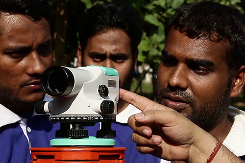
ITI Surveyor is a job-oriented, technical certification course related to the construction sector, after which students are likely to get a government job as well as a private job. The job of the surveyor is to determine the boundary of any land. Whenever there is a building, road, or other construction work, surveyors are needed there so that they can survey and make sure that the building or other structure is in place. With technological advancement, a lot of technology is used in the work of Surveying today. Surveying is very important for today’s technical and advanced world because the correct information given by the surveyor, first of all, ensures that a structure will remain intact for the time being.
Program Name- Surveyor
Minimum qualification – 10th Class
Total Course Fee- 60000/-
Fee Structure for Surveyor Course -
| 1st Year | |
| Admission Fees | 10000 |
| 1st instalment | 10000 |
| 2nd instalment | 10000 |
| 2nd Year | |
| Re-Registration Fees | 10000 |
| 1st instalment | 10000 |
| 2nd instalment | 10000 |
N.B. Special concession for SC/ST/OBC/MOBC and BPL Card Holders
Training Outcomes (Semester Wise)
First Year
Semester – I
- Concept of drawing & sheet layout.
- Draw lettering & numbering applying drawing instruments.
- Draw plain geometrical figures, curves & conics.
- Construct plain scale, diagonal scale, comparative scale, vernier scale.
- Draw orthographic projections of different objects with proper dimensioning & lettering.
- Draw conventional signs & symbols used in surveying.
- Perform site survey using chain/ tape & prepare a site plan.
- Perform the site survey using a prismatic compass.
- Perform Auto Cad drawing.
Semester – II
- Perform the site survey using a plane table.
- Perform theodolite survey.
- Perform traverse survey by theodolite & prepare a site map.
- Determine R.L & heights of different points by leveling instruments.
- Performing tachymetric survey using tacheometer.
- Perform AutoCAD drawing (single-story building)
Second Year
Semester – III
- Make a topography map using a level instrument with contours.
- Concept & set out of curves.
- Perform survey work using modern survey instruments (total station) to prepare a Map.
- Concept of cadastral survey & make a site plan.
- Perform a road project survey.
- Perform survey work to prepare a topographical map, cadastral map, road Project (Survey camp in a suitable hilly/undulated area).
- Perform AutoCAD drawing field survey data.
Semester – IV
- Concept & draw cartographic projection.
- Concept & use of GPS & GIS.
- Perform a Hydrographic survey using hydrographic survey instruments.
- Perform transmission line site survey & prepare a site plan
- Perform railway line site survey line survey using modern survey instruments.
- Draw a double storied building by AutoCAD & prepare a detailed estimate of the building.
Our Affiliations

SECRETARIAL PRACTICE
Course Detail
Stenographer And Secretar...
Course Detail
Draughtsman (civil)
Course Detail

